Welcome to a Lisianski Island Street View, by Google. Simply use your mouse for a virtual tour of Laysan Island, which is otherwise off-limits to the public.
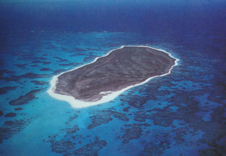
Lisianski Island is a low, flat island in the Pacific Ocean, part of the Northwestern Hawaiian Islands. It’s about 905 nautical miles northwest of Honolulu, Hawaii. Lisianski Island is about the size of Honolulu, with a land area of 384.425 acres and a maximum elevation of 40 feet above sea level. It’s made of sand and coral and is surrounded by a large coral reef ecosystem called Neva Shoal. Lisianski Island is part of the Hawaiian Islands National Wildlife Refuge and is administered by the United States Fish and Wildlife Service. It’s politically part of the City and County of Honolulu but has no resident human population. Lisianski Island was discovered by Captain Yuri Feodorovich Lisyansky (also known as Urey Lisianski) in 1805. He was a Russian naval officer and explorer who came across the island during his circumnavigation of the globe. The island was named in his honor, reflecting his role in its European discovery.
It’s important to note that it’s very likely that the island was known to Polynesian navigators, though there is limited historical documentation to confirm this.